Spring Hiking in Yosemite

Waterfall in Yosemite

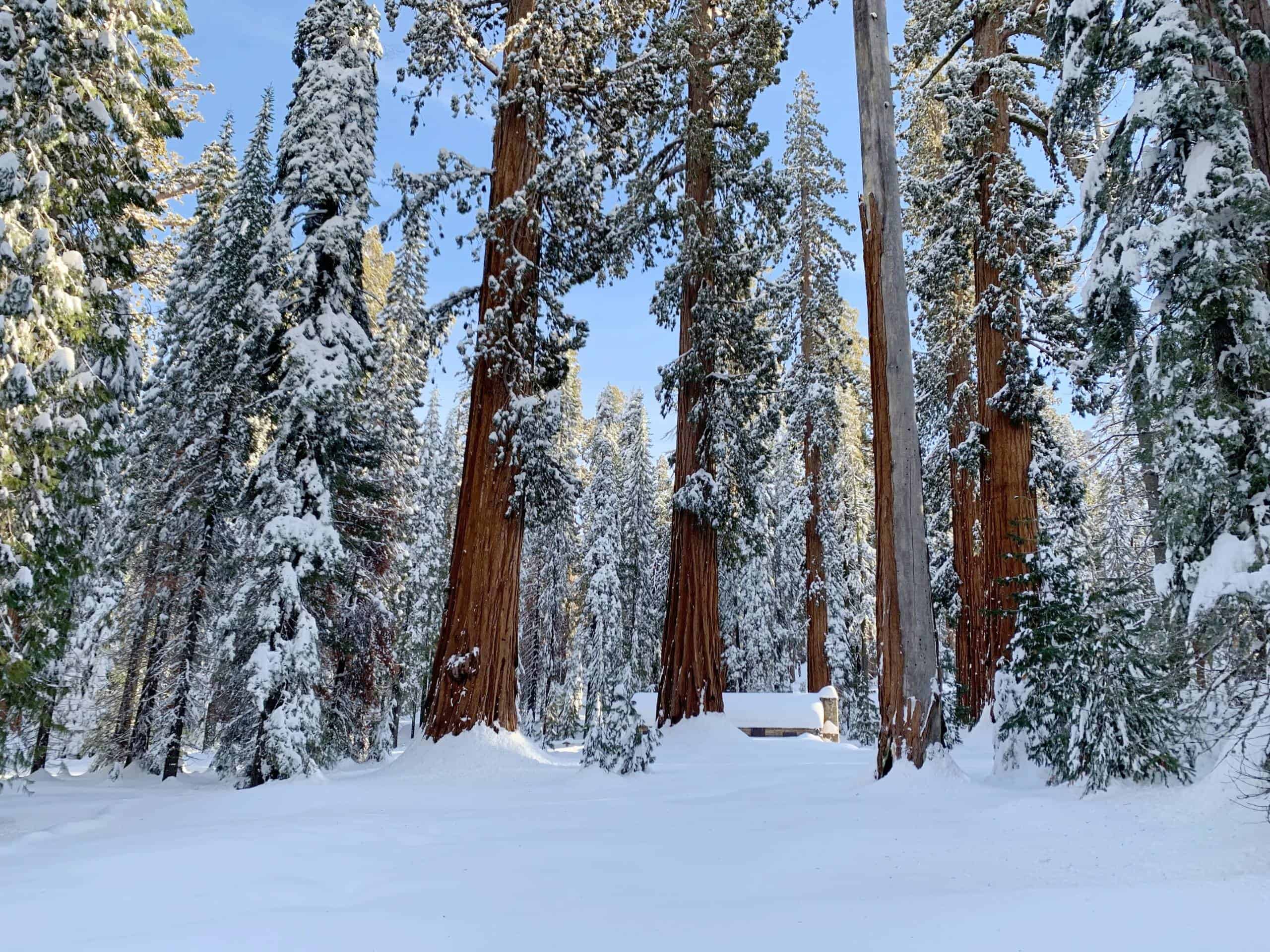
When the snow blankets the high country, where do you go?

Spring in Yosemite is one of the coveted times to visit. The waterfalls are booming, the wildflowers are blooming, the daytime temperatures range from cool to pleasant (and occasionally cold). It’s a magic time when you smell life rebounding on the air.

But spring comes late to the high country and that is all the more true in big snow years like 2023 or 2011 (or 2017 or 2019 for that matter). In terms of scenery and waterfalls, that’s great, but it does mean that hikers need to target lower-elevation hikes and perhaps pack a bit of extra gear they wouldn’t bring in midsummer.

Also, we hope it goes without saying that what follows are general guidelines and best guesses. There is no way to predict how much snow there will be at a given altitude on a given date until that date.

Contents

As this is quite long, here are some links to help you jump to the part that most interests you.

The National Park Service maintains a much more frequently updated Current Conditions page that includes information about hiking trails.

The Short Version

The short version of these thousands of words is simply this: in the spring, you want to focus on waterfalls and wildflowers.

  • Waterfalls: Yosemite Falls, Upper and Lower; Wapama Falls in Hetch Hetchy; and as the spring advances, Chilnualna Falls in Wawona and the Vernal and Nevada Falls in Yosemite Valley.
  • Wildflowers are less predictable, but the Hite’s Cove hike in the Lower Merced Canyon Area is the most famous. In general, you follow the flowers up in altitude as the season progresses until, by late August, spring finally comes to the high north slopes along the Sierra crest. So depending on the spring and the exact timing, you’ll find great flowers in the El Portal Area, Hetch Hetchy and the Wawona Meadow Loop. Of course, this can’t be predicted very far in advance.

April and May Hiking in Yosemite

First things first. Again, wildflowers and waterfalls are what draw people to the park in April, but April is a challenging month for hiking up high. Typically the Badger Pass ski area closes the last weekend of March and with it easy access to the high country. And, of course, even in a drought year, the Tioga Road opening is weeks away for the early-April visitor.

In general, this means that spring hikes start from lower altitude trailheads (Yosemite Valley, Wawona, Hetch Hetchy). Some of the hallmark spring walks are even lower, such as the famous Hite’s Cove wildflower walk.

In a drought year, things might start to open higher up as early as the end of April, but in an average year, April is still snowy month above 6000 feet. The park service does not even start plowing the high-elevation roads until April 15 and it is quite an involved process getting the Glacier Point Road and Tioga Road open.

In most years, you should not expect Glacier Point Road to be open in April, and in many years it will not open until late May.

The Tioga Road basically never opens in April and opens before the end of May only in low-snow years. In heavy snow years, it will take much of June, even into July, to get the road open.

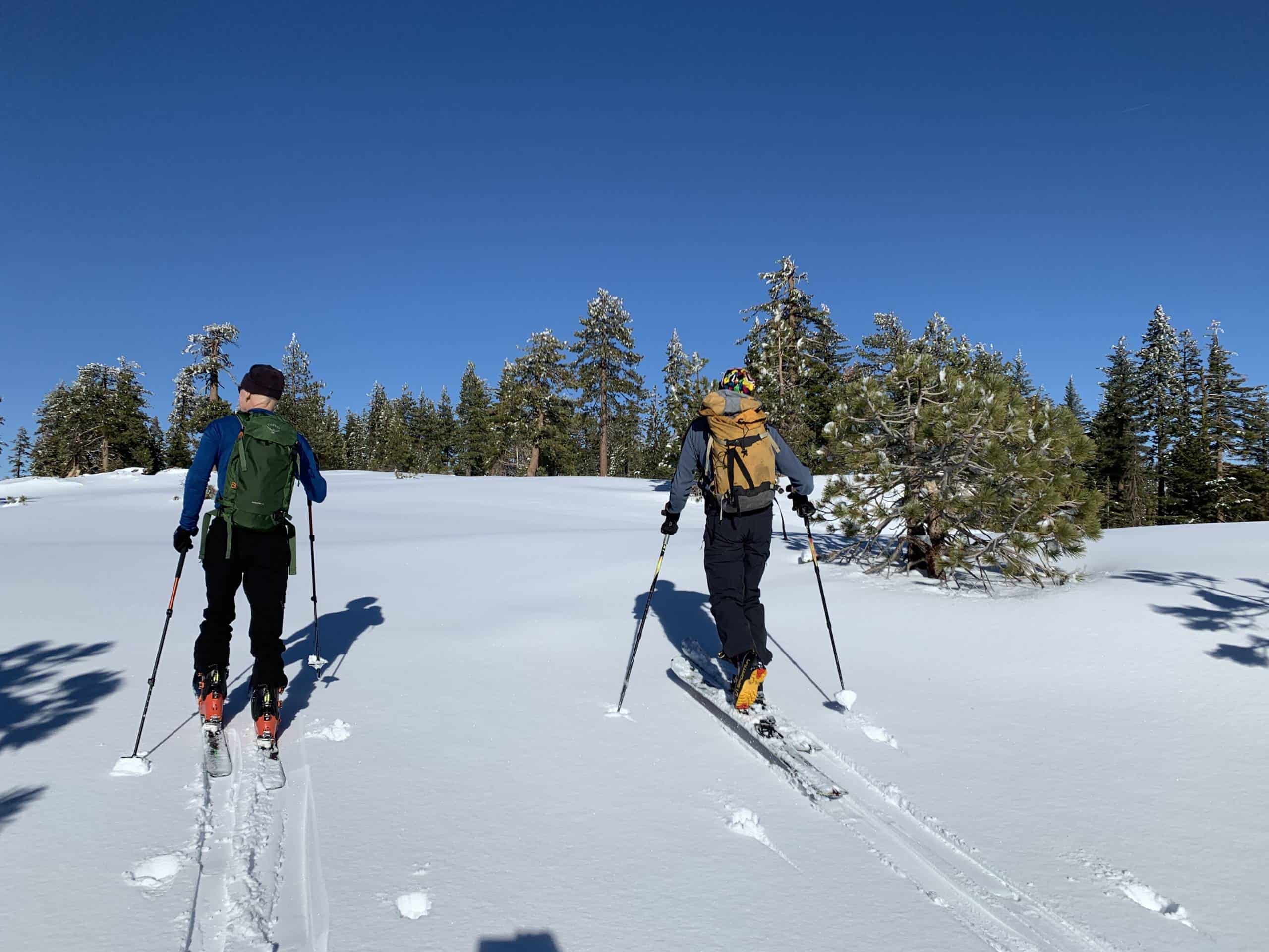
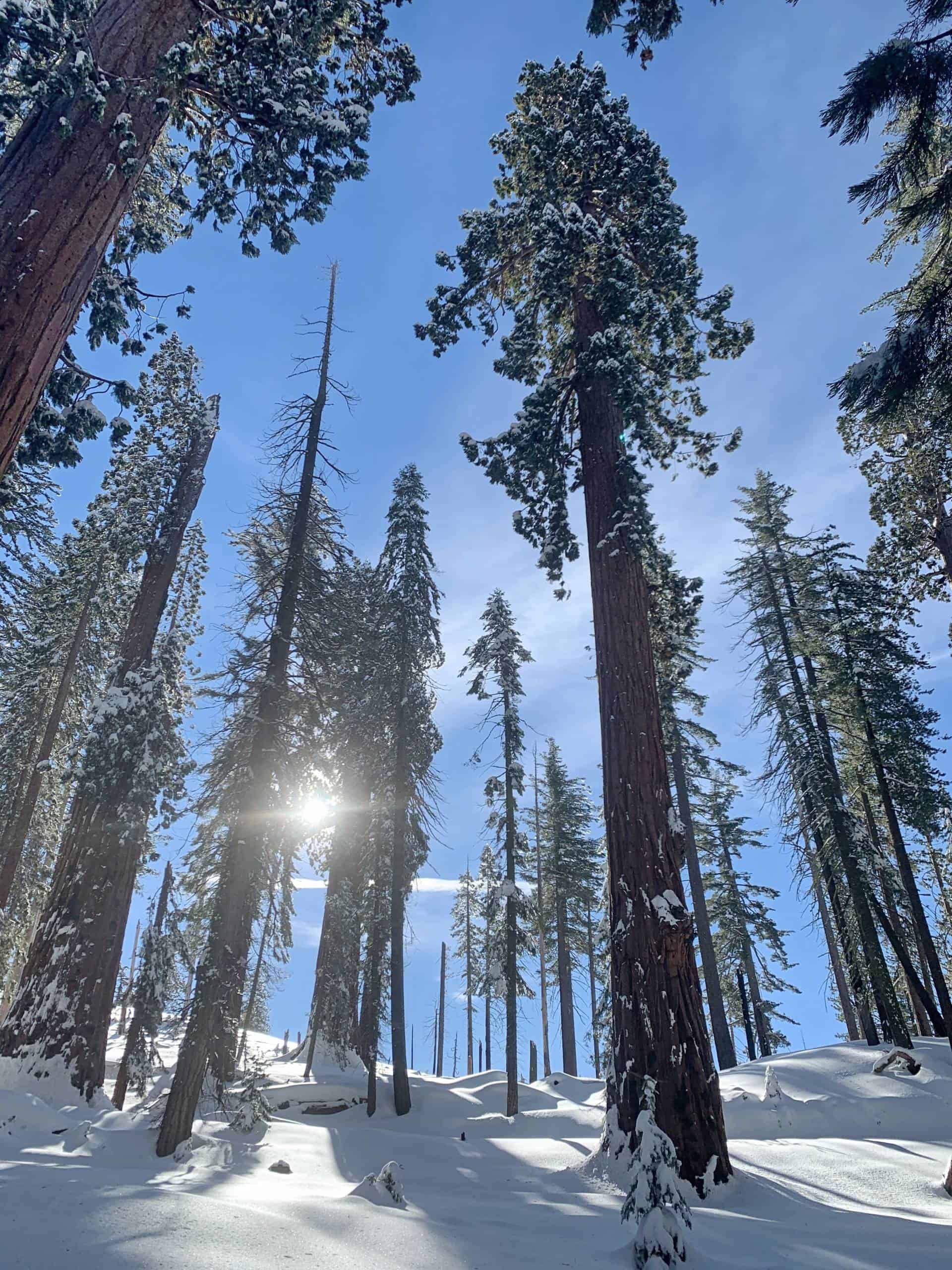
If you are a skier, April and May are commonly good months to hike to snowline and get some great corn skiing. In a big snow year, you can just hike higher and higher and keep skiing all summer long if you’re willing to go high enough.

Down in Yosemite Valley, Wawona and Hetch Hetchy, April can feel like summer or winter. On the day I write this, April 4, 2023, it was 18 degrees this morning and only warmed up to 37 and sunny by afternoon. Just five days from now, it is forecast to be 66 and sunny. Some Aprils have no precipitation. Our first April living in Yosemite West (2003), it snowed something like 20 days. In short, for an April visit you may encounter conditions that feel a lot like winter or conditions that feel a lot like summer. Flexibility is mandatory in April, much like in visiting Yosemite in November.

By May, precipitation is less common, but we can get snow. In fact, there is a local saying that it always snows once on the dogwood blossoms, which typically peak around Mother’s Day (second Sunday of May in the US). We even occasionally have snowstorms in June, with the latest being four inches of snowfall on June 12 at our house.

We can’t talk about spring without mentioning waterfalls. Usually the peak runoff is late April in a drought year and late May in a big snow year, with May 15 being the rough average in an average winter. That said, it’s hard to tell with the naked eye when the falls are at peak. Generally, early April to late May will have excellent waterfall viewing and destinations with waterfalls and cascades (and wildflowers) should go at the top of your list.

Recommended Gear

People differ on what they like for gear, but if you are going to be hiking up in the higher elevations (that is, above the Valley floor), you might find microspikes and poles useful.

Tom never uses microspikes, but uses poles often. Theresa rarely, but occasionally, uses some extra traction on her feet and also uses poles most of the time. You can get microspikes for as little as $10-$20 on Amazon like these:

Fancy brands like a gold-standard Katoola will set you back $75. For us, the really aggressive (and expensive) ones are overkill for what most people need. You’re basically looking for a bit of extra traction on trails that have been packed firm.

Poles are much the same. Because we use poles a lot, we have expensive, super light, carbon fiber poles (which we love). But mostly with poles you are paying for lighter weight. For most people a pair of budget poles is all you need. You can sometimes find them at Costco or other budget stores. Sierra Trading Post has a decent selection of poles for under $30. One caveat: you cannot bring poles in carry-on luggage. Typically for a spring trip, you’ll need to check a bag anyway because you’ll be bringing more clothes, but it’s good to be prepared for this.

Extra shoes are handy if you have them. A lot of the trails have wet spots throughout the spring and well into summer in a big snow year. It’s nice to have dry shoes for the car or going out to eat or whatever. Two pair of comfy shoes is a worthwhile luxury in the spring.

Lots of socks. As a corollary to the advice to bring extra shoes, extra socks will be welcome too.

And, of course, it can still be chilly and we can still get precipitation, so a warm layer, a warm hat and a rain layer are all wise to have with you.

Beyond that, all your usual walking stuff. Days are getting longer, but it’s still not summer, so a headlamp is also an excellent idea.

The Mist Trail, JMT and Four Mile Trail

Most trails are open all year. If you have the gear and the experience, you can hike in the dead of winter. We’ve hiked Half Dome in January and skied Mount Starr King in February. There are three exceptions to this rule where trails have hard closures, meaning it is illegal to jump the gate and hike the trail. This is because there is a place on the Mist Trail and place on the John Muir Trail subject to ice fall, and there is a place on the Four Mile Trail subject to avalanche with a nasty fall if you were to slip crossing the icy avalanche debris.

Note that you can pretty much always hike to the top of Vernal and Nevada Falls, as we did even in the heavy snow year of February 2023 (and many other times), but you follow a special winter route that goes up the bottom of John Muir Trail to Clark Point, then comes down to join the Mist Trail just above the top of Vernal Fall. From where you join the Mist Trail it is just a short detour to the top of Vernal Fall. Overall, the winter route is perhaps a mile longer than the most direct summer route.

The park service maintains a super helpful web page on historic opening dates for roads, trails and campgrounds.

A quick look shows:

  • The Mist Trail up the Vernal Falls stairs typically opens in late March, but that can get extended to late April in a big snow year.
  • The John Muir Trail through the Ice Cut typically opens in late April to mid-May.
  • The Four Mile Trail was still closed in mid-May for six of the last 14 years (2010 to 2023).

Again, for hiking to see Vernal and Nevada Falls, you have a winter option that is just a bit longer. For the Four Mile Trail, however, there is no nearby option of similar length for getting to Glacier Point. Simply put, for the vast majority if hikers, if the Four Mile Trail is closed, Glacier Point is probably too far for you to hike to.

Where Is the Good Spring Hiking?

Of course, we can’t predict the future and when a given trail will open in a given year, but here are some options for the early season. In some years, “early” means April, maybe even late March in a record drought year like 2015. In other years, “early” means May and into June.

Yosemite Valley Area

  • Upper Yosemite Falls Trail and Yosemite Point. This gets a lot of sun and melts out quickly except for a couple places in the middle where snow sloughs off the cliffs above and piles up at the base. These areas can be snowy well into summer and many people like to have microspikes for these sections especially as the season wears on and they get firmer and firmer. The sunny upper reaches melt out faster. If you want to go on past the top of the falls, the deep forests as you go toward Eagle Peak and El Capitan hold snow quite late. The sunny slopes up toward Yosemite Point melt out earlier.
  • Mist Trail and John Muir Trail (see above).
  • Pohono Trail to Artist Point, Inspiration Point and, as spring wears on, Old Inspiration Point (6640′). Beyond Old Inspiration Point, the trail goes up above 7000 feet and stays pretty high, reaching 7336′ by Dewey Point, so it takes longer to melt out.
  • Valley Loop Trail. The west end is surprisingly nice given its proximity to the road. I (Tom) avoided this for years even though a fellow ranger told me it was his favorite walk in the Valley. I finally did it and, though not my favorite, it’s a surprisingly peaceful tour of the Valley.
  • Mirror Lake Trail. This is the the east end of the Valley Loop Trail and is also the start to the Snow Creek Trail (below). It has nice views of Half Dome and Watkins. The loop around Mirror Lake is also nice and we love the part that passes under the shadow of Half Dome, but that shadow of Half Dome makes snow linger there longer than other places. Between water on the trail and snow, it can be a bit of an adventure in the early season.
  • Snow Creek Trail. This leaves from near the east end of the north side of the Mirror Lake Loop. The attraction of the Snow Creek Trail is not so much in doing the whole trail, but getting above treeline. It has a lot of slabs and open areas and 15-30 minutes of walking gets you to a nice open slab to have lunch with unobstructed views across to Half Dome. If you continue to the top where you re-enter the forest, the snow can linger long there in the shade.
  • Old Big Oak Flat Road from the wood yard near the west end of El Capitan. Again, very sunny. Great views of El Capitan and Bridalveil Fall. The caveat here is that though this was once the main road into Yosemite Valley, this is considered a cross-country route now as the rockslides have reclaimed sections (indeed, the trailhead is called the Rockslides Trailhead when applying for a wilderness permit). So especially in the spring when winter rains and runoff have loosened things up, it is important to exercise great caution when moving around any rocks that could potentially move. That said, the bottom of it is quite safe and gets you to an open talus field with excellent views.

Wawona Area and the Mariposa Grove

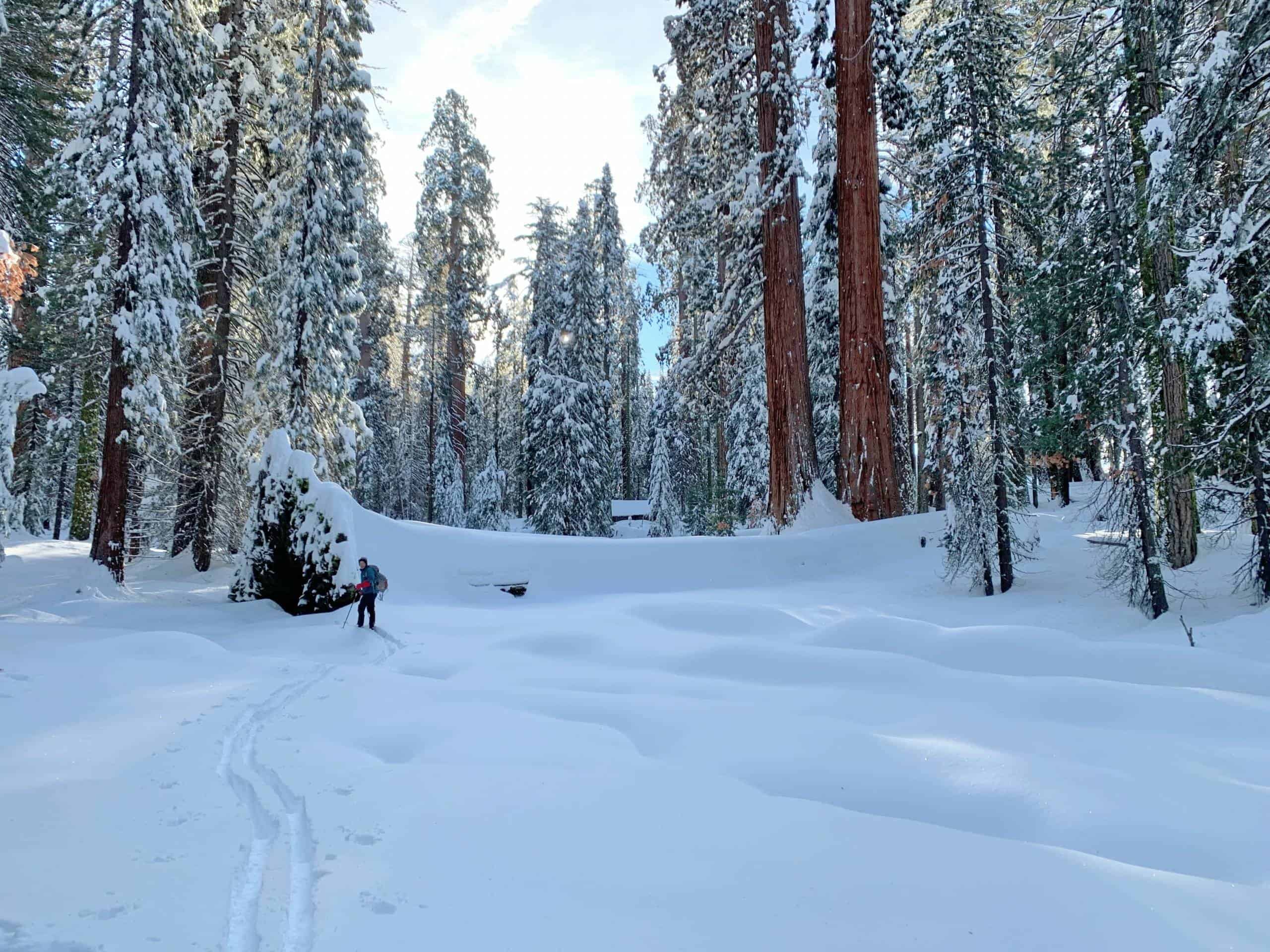
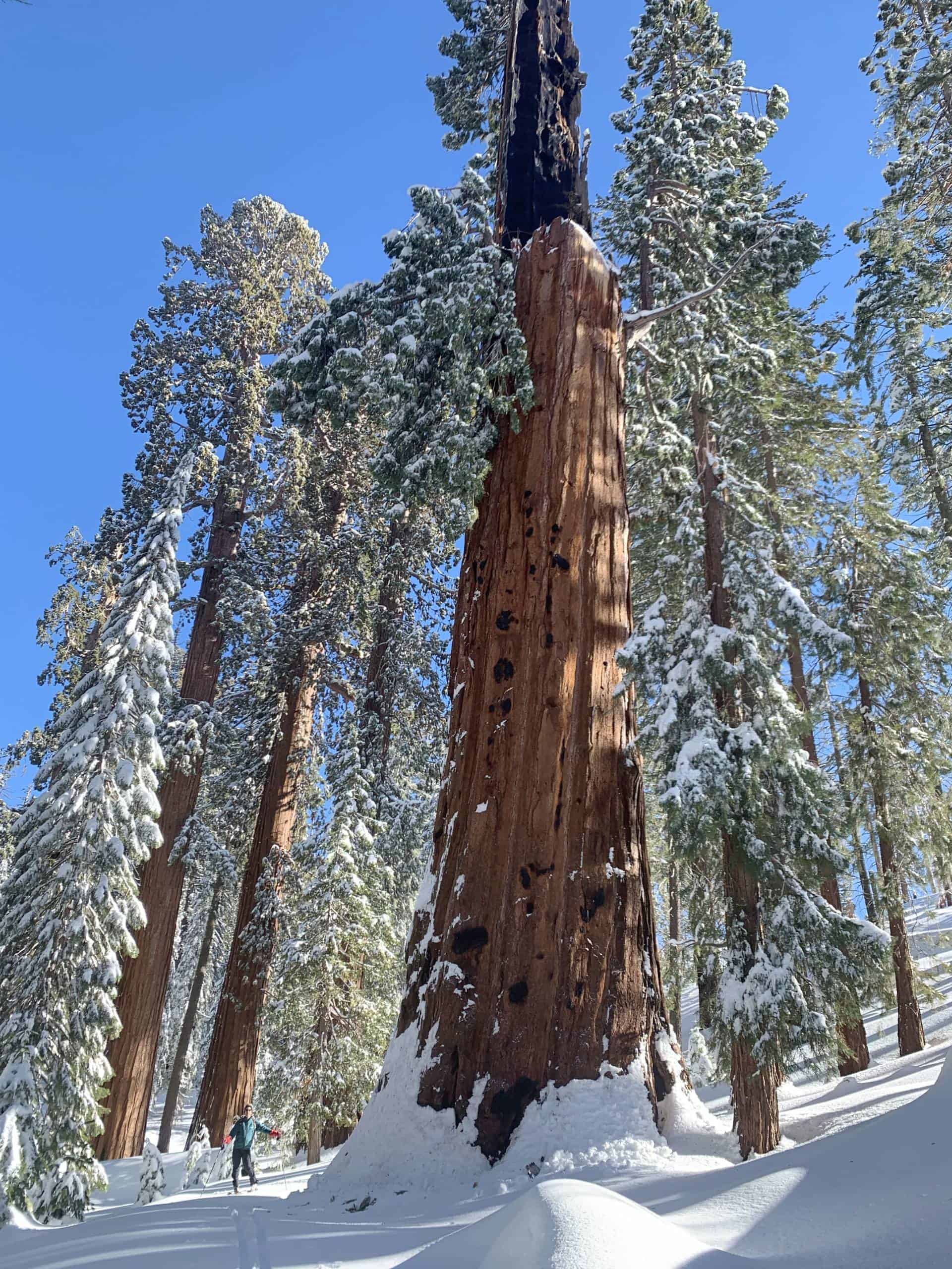
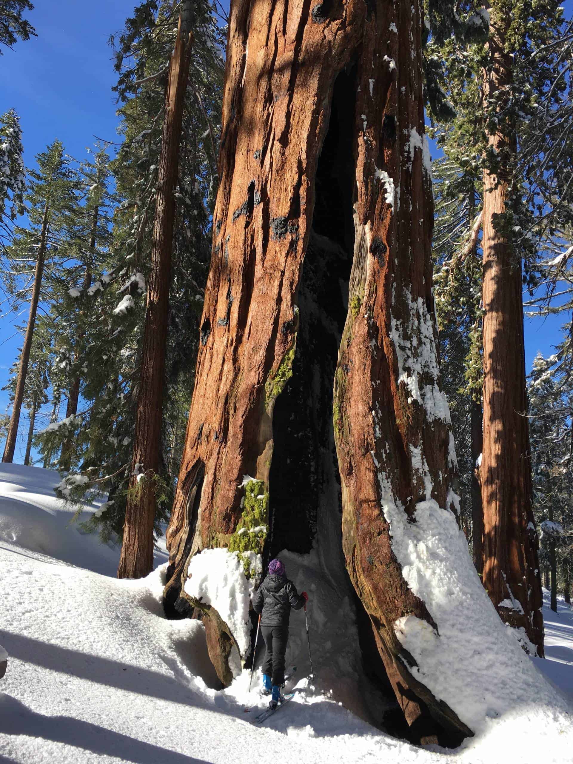
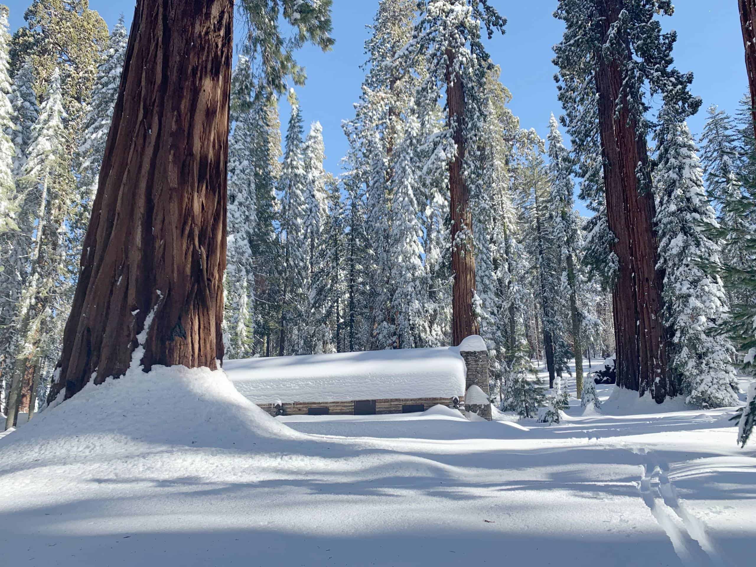
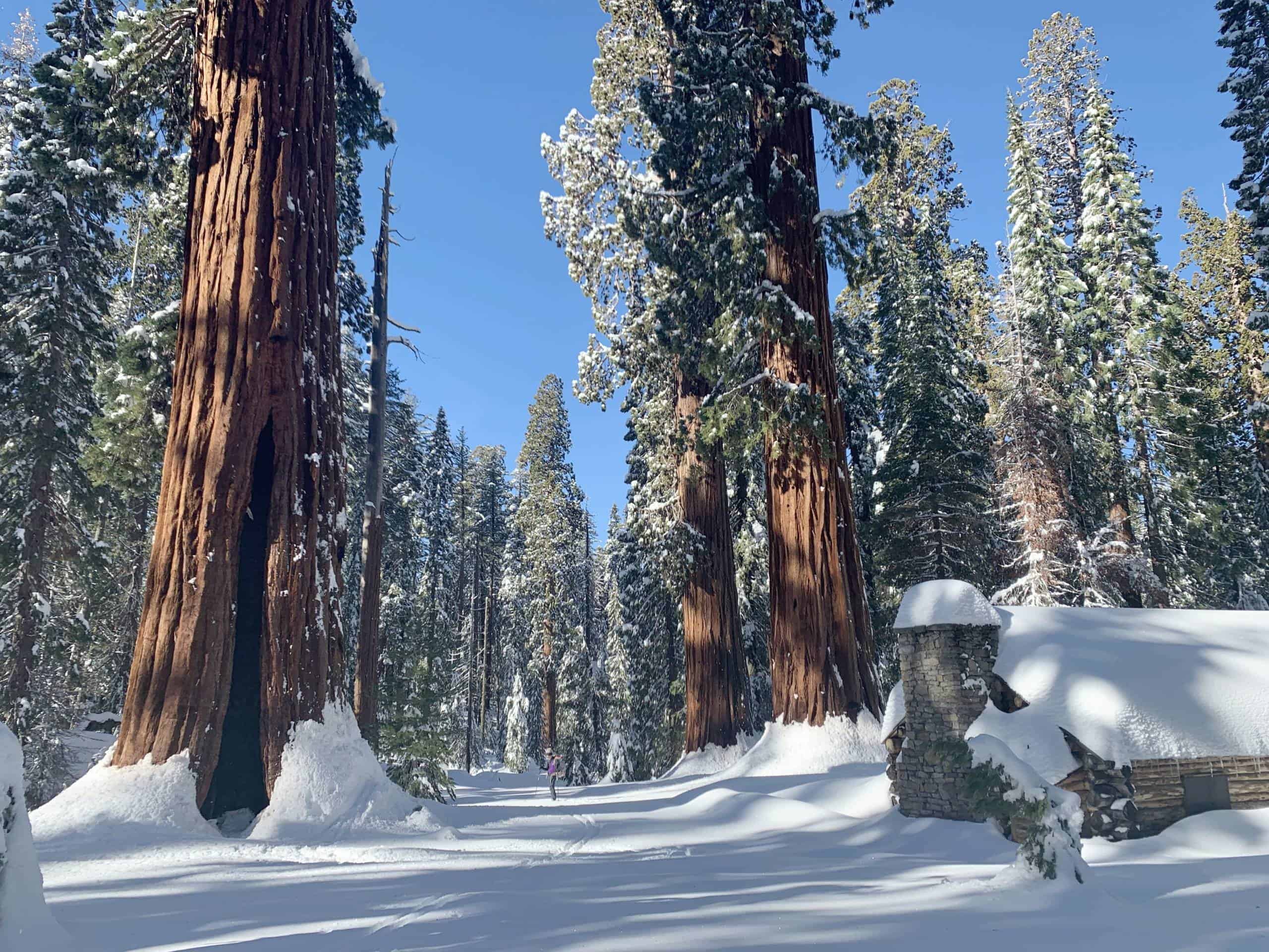
  • Mariposa Grove. The grove is “open” year round. In fact, we spent a wonderful New Years Eve 2022 camped in the Upper Grove near the museum with five feet of fresh snow on the ground. The question is really whether or not the shuttles are running and how much snow is on the trail.
    • To answer the first question: no. Shuttles run roughly Memorial Day to November 1. Outside of those dates, you have to walk the two miles to the summer shuttle terminus. So while the road might be “open” if you have a handicap placard, that doesn’t mean the shuttle is running.
    • As for the amount of snow, our pictures from mid-April 2011 (the heaviest snow year between 1982 and 2023) show a lot of snow in the grove, but my pictures from May 20 show us walking on pavement. In low snow years, the road will likely be melted out in early April. The parking lot is at 5,200 feet and the first sequoia trees are at 5,600 feet, almost exactly the same as our house. So the snow at our house will give a rough sense of how much snow there will be at the bottom of the Mariposa Grove. Generally, people hike this all winter and it gets packed out even if there is snow. I would expect this to be quite hikable within a few days of most storms.
  • Chilnualna Falls Trail goes quite high (6,500 feet for the upper cascade), like the Upper Falls Trail, but like the Falls Trail, it is south-facing along most of its length. Of course, the higher you get the more likely to encounter snow. The lower cascade at the start of the trail is a striking destination in itself, even if it is only a few minutes from the car. From there, the trail is sunny and faces south and southwest for most of its distance so the snow retreats early, but expect snow to linger much longer on steeper slopes of the last half mile or so.
  • Wawona Meadow Loop. This is only about 3.5 miles. I (Tom) used to run it a lot after work. It’s main attraction is that in the right season it has a wide variety of wildflowers. In some periods it will have big, showy displays, but the main attraction is variety. We’ve counted more than 50 species in bloom on some walks. You can couple this with the Yosemite History Center or a walk across Swinging Bridge, another short walk (less than a mile each way) in Wawona that takes you across an old suspension footbridge. Like the Golden Gate Bridge, just much much much smaller.
  • Alder Creek Trail. This is about halfway between Yosemite West and Wawona. It’s not one of the iconic falls in Yosemite, but it’s a pleasant hike to a waterfall that is maybe 75 feet tall. There’s also a bit of logging history there — the last part of the trail is the old logging railroad bed that once ran from El Portal, through Yosemite West, all the way out to Alder Creek Fall. When you come into Yosemite West, you’re driving on the same railroad bed that ends at Alder Creek Fall. The fall is at about 5600 feet, roughly the altitude of our house. So when the snow is gone in the shady areas around the house, it should be mostly gone from the Alder Creek Trail too.
  • Lewis Creek. Like Alder Creek, this is not really in the Wawona Area, but it’s along the same road. The Lewis Creek hike is outside the park about halfway to Oakhurst on Highway 41, and known for Corlieu Falls and Red Rock Falls. A bit obscure, but not a bad walk, especially if the flowers are in. See the description on Yosemite Hikes.

El Portal, Foresta and the Lower Merced Canyon

  • Hite’s Cove outside the park is the most famous wildflower walk in the region. It also walks through the stunning steep canyon of the South Fork of the Merced River. The trail itself, however, is only steep along brief sections as it mostly contours along the canyon wall. Normally the wildflower blooms are a mid-March to mid-May event, but obviously that shifts depending on the weather. Amazing when in bloom. It was this hike that turned me (Tom) from a person who didn’t think about flowers to a wildflower obsessive for several years. People often post conditions on the California Wildflower Report Facebook Page (no account necessary to view and read).
  • Foresta Falls from Foresta (short) or El Portal (long). The El Portal version would likely only be worth it if the flowers were in bloom or you just wanted a long, possibly rather hot, walk. You can also do the somewhat longer Little Nellie Falls from Foresta. Though higher than Yosemite Valley, the lack of steep walls means this area gets a ton of sun and is already melted out as we looked across from Wawona Road on April 1, 2023, the all-time record snow year.
  • Merced River Trail. This is a fair bit outside the park, but a good option if higher things are snowy. More on the Merced River Trail.
  • Zephyr Rafting. Okay, this is not a trail, but it’s a great way to see the Merced River Canyon from river level. It’s pricey, but a fun day in high spring flows. There are a couple of outfits, but we’ve always had a good experience with Zephyr Rafting.

Hetch Hetchy Area

  • Hetch Hetchy, Wapama Falls, Poopenaut Valley. At the same altitude as Yosemite Valley, this is one of the first places in the park to melt out.
    • Wapama Falls is about five miles round trip to the bridge. The park service is moving the bridge to make it passable in high water, but until that is done, the bridge will be the end of your walk in spring. Two backpackers were killed in June 2011 trying to cross this bridge in high water. Another was killed more recently (2017?). Don’t take chances. In any case, you do not need to cross the bridge to get nice views of Wapama Falls and the smaller Tueeulala Falls along the way. And if you hit it right, the flowers can be amazing.
    • Above Hetch Hetchy. There are other options out of Hetch Hetchy as well, such as taking the left fork and hiking up and out toward Beehive rather than staying at the reservoir level as for Wapama Falls. Of course, this trail will eventually take you into snow country, but the pleasure of this hike in the early season is the wildflowers that line the trail low down.
    • Poopenaut Valley. Before arriving at the main Hetch Hetchy parking, you’ll pass the trailhead for Poopenaut Valley, a valley at the bottom of the Tuolumne River Canyon at one of the lowest altitudes in the park.
  • Carlon Falls along the road to Hetch Hetchy. A short hike to a small but popular waterfall.

Tuolumne and Merced Groves (near Crane Flat)

  • The smaller cousins to the Mariposa Grove. They have far fewer trees (a couple dozen each versus hundreds) but when the Mariposa Grove shuttle isn’t running, these groves offer a shorter walk (one mile to the first mature sequoias instead of two for the Mariposa Grove) and some great trees. They both start above the groves and hike down, so the trailhead is 1,000 feet higher than the trailhead for the Mariposa Grove. That means they will be snowy longer in the spring, but people hike these trails all winter long and they typically get packed out for relatively easy walking. Many hikers will want microspikes and/or hiking poles as the packed snow gets slippery and can turn to ice. Both groves are nice, but parking is quite limited in the Merced Grove, so it can be more of a challenge.

Miscellaneous

Because people have asked.

  • Panorama Trail. Generally faces south over the high-altitude portion, so those slopes melt out quickly compared to the Four Mile Trail on the shady side of Glacier Point. In the shadier areas down lower, snow will linger longer. Usually by mid-May the snow should be quite consolidated so walking is usually not bad. Poles help. That said, it’s a long hike as an out and back when the Four Mile Trail is closed.
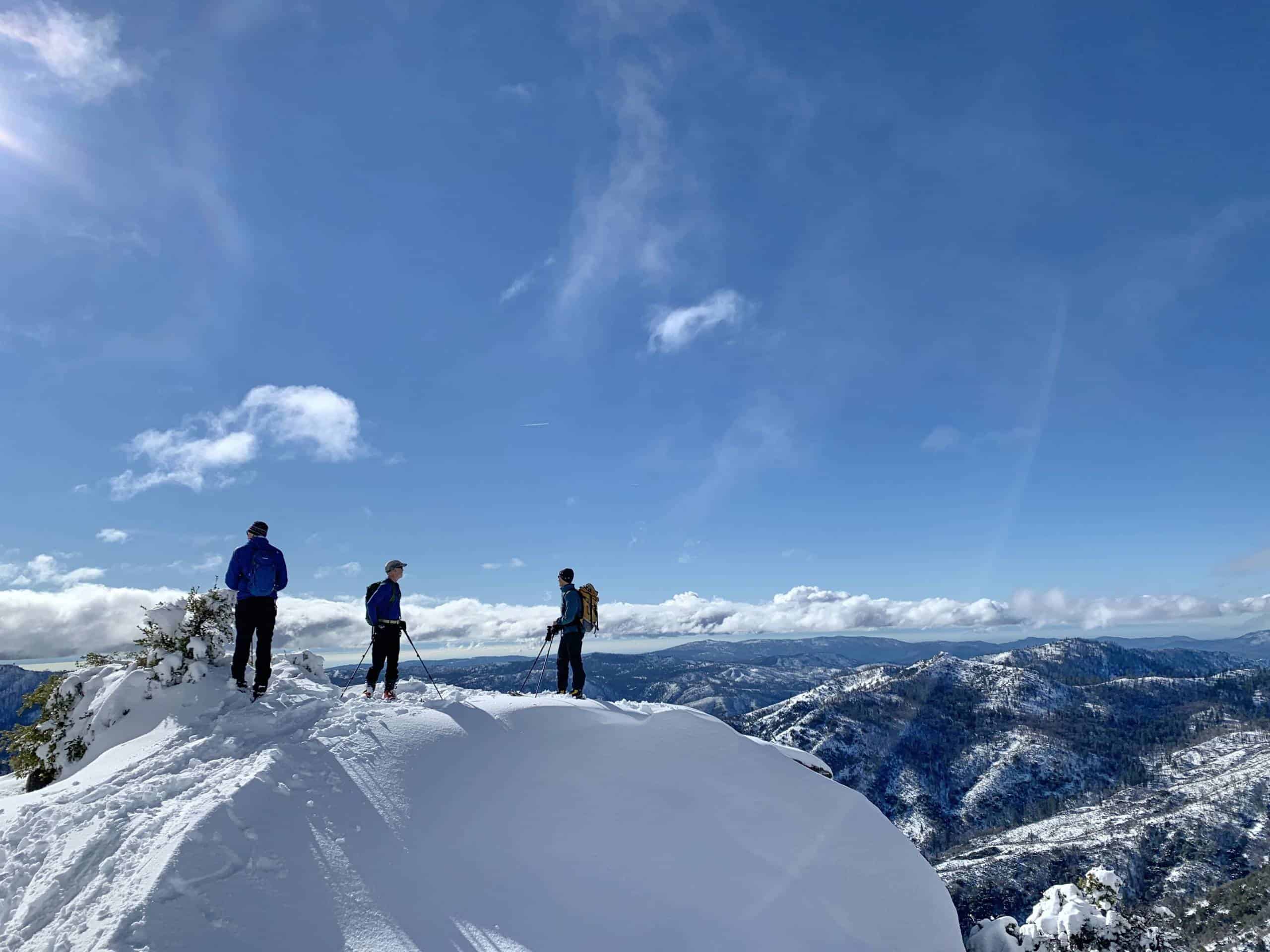
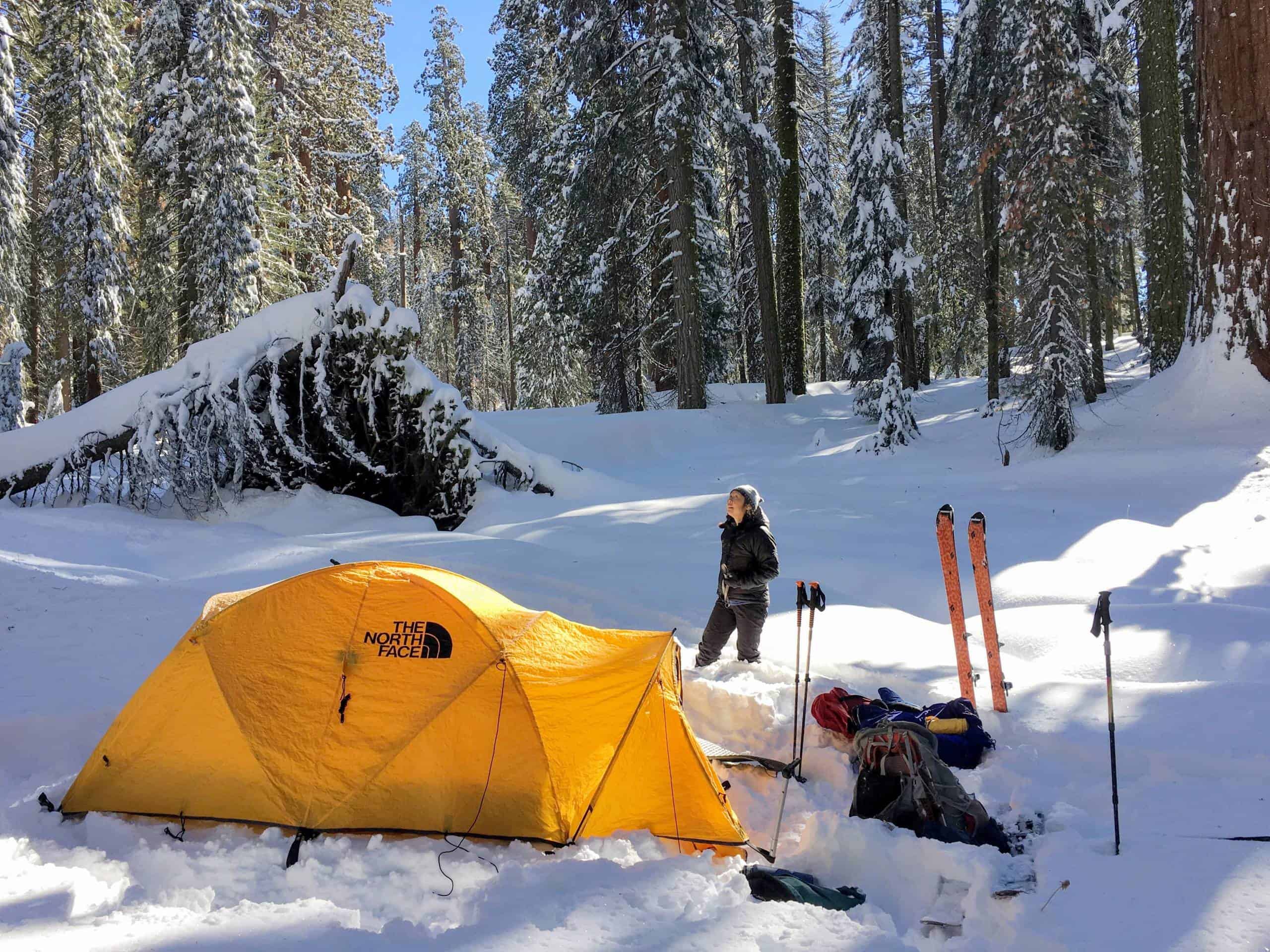
  • High trails, peaks and passes. These are all open. They are always open. But in the spring, the approach is long and you will need skis and winter camping experience. If you fall into that category, it can be awesome. We skied Mount Starr King in February 2023. We climbed Snake Dike on Half Dome and came down the Cables Route in January 2012. If you have the gear, energy and experience, very little is truly off limits, but some hikes that are easy dayhikes in the summer might be multi-day expeditions in February or April. There is one caveat though: unbridged creek crossings present a genuine danger. If you want to get deep into the backcountry early in the year, try to plan to routes that avoid unbridged creek crossings.

Definitely Not Open

  • Tioga Road. Any opening before Memorial Day is considered early. In big snow years, the road has opened as late as July 1.
  • Glacer Point Road will occasionally open in April in severe drought years, but usually NPS targets mid to late May.
  • Half Dome Cables. The Park Service usually gets the cables up in time for Memorial Day Weekend. Sometimes it’s a week or more earlier and in a big snow year it can be quite a bit later.

Other Questions?

If you have other questions, drop us a line. And again, these are general guidelines and best guesses. There’s a reason the National Park Service is vague on their website: these things genuinely cannot be predicted. There is no formula. A moderate snow year with a very very cold spring might see some trails slower to melt out than a big year with a very very hot spring. Who knows what will happen? And that’s part of the fun, right? If we knew what was going to happen every time we walked out the door, would there be any point in walking out the door at all?

Winter Time Machine: Animal Tracking in the Snow

Coyote in in the snow

Winter in Yosemite

Winter is the quiet time in Yosemite. Days are short, there are fewer visitors and many of the animals spend a lot of their time hidden. Ground squirrels, bears and, of course, cold-blooded animals hunker down in hibernation or torpor for the winter. In very cold places, toads will burrow as deep as three feet to hibernate.

Some animals are active all winter, but nevertheless usually hidden. Meadow voles and mice live out much of their winters in the space that forms between the snowpack and the ground, the subnivean layer. There the warmth from the ground and the insulating layer of the snow keep the temperatures around freezing and the snow protects them from the elements. Unfortunately for the mice and voles, though, long-tailed weasels are well-adapted to hunt in the subnivean layer with their long, skinny bodies and keen sense of smell.

Despite the seeming quiet, there is still a lot going on above the ground. Coyotes and bobcats hunt the meadows when snow cover is thin. Using their acute senses of hearing and smell, they locate animals below the surface and then pounce. The coyote makes a big arcing jump, coming down mouth first, diving into the snow and fairly regularly coming up with a small meal.

The Time Machine

The real pleasure of the winter, though, is the winter time machine – animal tracks. Why are tracks a time machine? Because they allow us to go back in time and see what has happened in the forest since the last snow. One of our winter pleasures is putting on our skis and getting out into the woods shortly after a storm. It’s often surprising how much activity there has been, even in just a few hours after the end of the storm. So while the cold and snow make harder to see animals, it is far easier to see signs showing which animals have recently been out and about and where they were going.

Squirrels

We know, a lot of people are not fans of squirrels, but they are nearly ubiquitous in North America so almost everyone who lives in a place with snow can track them. And squirrels are fascinating animals, fun to watch and to track, especially Theresa’s favorite animal, the chickaree or Douglas squirrel (Tamiasciurus douglasii), a close relative of the more widely-distributed red squirrel (Tamiasciurus hudsonicus). How could you not want to track this guy?

Chickaree or Douglas squirrel (Tamiasciurus douglasii) perched on a long in our yard in Yosemite West
Chickaree looking like what it is: a spring-loaded bundle of lightning ready to explode into motion.

The first thing to notice about squirrels is just how active they are as soon as the storm ends. On a sunny morning after a night of snowfall, the tracks will be everywhere. In the deep cold of winter nights, squirrels often congregate in group nests to stay warm, with males and females gathering in separate nests. But when day breaks, they are out and about. We actually see very few of them compared to summer, but the tracks let you peer into the past to see what they’ve been up to since the end of the storm.

Squirrel tracks also tell the story of how squirrels travel in snow. One thing to note is that the hind feet land in front of the forefeet when squirrels are bounding. Also tracks typically connect tree to tree, rarely passing through any real distance in the open. In soft snow, the squirrels climb a few feet up the tree and then hurl themselves off. We sometimes like to set our skis next to the tracks to estimate just how far they jump. Tom skis a 165cm (roughly 65-inch) ski and the jumps are commonly longer than his skis, so six or more feet.

Notice how the squirrel goes to the first stump, then launches for a full six feet leaving a mini crater in the snow, then goes to the next tree and jumps 3-4 feet at a right angle.

Why? In soft snow, squirrels are slow waders/paddlers and easy prey. They look like they are swimming, which effectively they are, which makes them slow and vulnerable in light snow. Being such agile climbers and jumpers, it takes less energy and reduces the amount of time they spend out exposed to raptors, bobcats and coyotes if they climb up a few feet and get the next six feet of travel practically for free and almost instantly and then race to the next safe spot.

In very deep snow, they can get even more creative. One time Tom was out alone in one of our favorite spots and in his far peripheral vision he saw what he first thought was a raptor diving from the sky. Instead, it was a squirrel coming in for a landing in what seemed like open ground. The squirrel had walked out along a branch that was maybe 10 feet long and 15 feet up and hurled itself off. In so doing it covered most of the 20 feet between the tree it started on and the sheltering branches of a young sapling buried in snow. As soon as it hit the ground, it started paddling through the snow like it was swimming in a race and soon reached the sapling. The gaps in the snowpack created by the branches of the sapling gave it ready access to the world beneath the snow and down it went, within a few seconds safe from surface hunters.

It’s rare that we get to see these travel jumps, but the tracks tell the tale. It’s easy to ignore such a common animal, but that very ubiquity is one of the things that makes it fun — you don’t have to be a squirrel whisperer to find some tracks to follow.

The great thing about tree squirrels is that they are active all winter and numerous. So it’s rare to go out in freshly-fallen snow and not be able to at least find a squirrel track to follow and study. And there always seems to be something new to learn even from this most common animal.


Mountain Lion Tracks

Mountain lion in profile
Historic photo of mountain lion in Yosemite (Dixon Collection, NPS, public domain)

In 20 years of living in Yosemite, neither of us has seen a mountain lion (cougar, puma), but fresh tracks in the snow right after a storm sometimes tell us that we have missed a cougar by less than two hours.

One time we saw impressively large cougar tracks come to a set of manzanita bushes. The group of bushes was about fifteen feet in diameter but only a couple feet tall. You would think the easy thing to do would be to a go around, but apparently not. We could see the normal walking track of the lion then, as it approached the bushes, the forefeet and hindfeet bunching together as the cat readied to spring, then nothing. On the other side, we found the bunched tracks of the landing, then back to walking along on its merry way. It looked like the 15-20-foot jump was as trivial as a yawn, not even worth a 20-foot detour to avoid. Sure, we never saw the actual cat, but the tracks gave us a feel for the awesome agility and power of the animal and our minds recreated the scene almost as if we had seen the cat itself.

Mountain lion tracks in the snow with a shoe for perspective
Tracking big cats in fresh snow above the Mariposa Grove!

On another occasion, Tom went for a morning run after a small dusting of snow from the night day and saw not one, not two, but three parallel sets of cougar tracks. That meant there were either three cats in the woods or one cat that has passed by three times in less than twelve hours. Both possibilities were sobering. He spent the rest of the run yelling and making noise (a few months later a park service game camera in the area captured three cats traveling together, probably a mother and two daughters).

While we have seen mountain lion tracks many times in the snow, we only have the one good photo (above). But we have taken some pictures of tracks here in Yosemite West. Note the three-lobed rear pad and the round footprint, clear signs of a cat.

Again, despite countless hours and miles in the forest and despite dozens of sightings of tracks, neither of us has ever seen one of these cats in the wild. But by paying attention to the tracks that let us go back in time and see who was in the woods shortly before us, we have had several “sightings” of mountain lions, disconnected in time.


Bear Tracks in Winter

Many people think bears hibernate all winter and are never active. We have seen bears down in Yosemite Valley in February feeding on a deer carcass from a mountain lion kill. If there’s food, males and non-pregnant females do not need to hibernate (technically, enter torpor as bears are not true hibernators). Up higher, at our house and above, there is almost never enough winter food, so all bears den up for the winter And yet, every winter, we see bear tracks in the snow.

Two bears in Yosemite Valley in February snow
February in the Valley. Deer carcass from a mountain lion kill is just out of picture. We watched these two, probably siblings, play fight, then eat, the play fight some more, then wander to the river to drink, then come back and eat and fight some more.

Bears, as it turns out, do not have watches or iPhones to tell them what day it is, so if they don’t have a den full of cubs, they get up and take a walk and, finding inadequate food, go back into torpor. They might also be out and about if their den was damaged or flooded and need to find a new place to bed down. In any case, we have never seen a high-country bear in winter, but we have seen their tracks in just about every month of the winter.

November

December

January

These are not as clear in the photo, but they are certainly bear tracks, certainly from January (2018) and sort of neat in that if you look you can see the claw marks.

February

We didn’t find any photos of March bear tracks in our library, but there might be some lurking there. In any case, we have seen bears or bear tracks in virtually every month, including not just in Yosemite Valley but up in the higher elevations. The February photos are from elevations of roughly 7000 and 8000 feet, respectively, with a heavy snowpack on the ground.

Also note that you can find bear “tracks” other places than the ground. Sometimes they scratch trees. One theory is that they are trying to show other bears how big they are so they can scare smaller bears off their territory. Not sure if that is just an old myth or has any real research behind it.

How big was the bear?

Interestingly, in this very snowy winter of 2023 we have been getting out more than usual, and yet we have seen no bear tracks since early December. Apparently very deep snowpacks makes for good sleeping.


Following a Fox and a Bobcat

One of our best tracking expeditions came after an early-season storm that dropped just a few inches of snow on otherwise bare ground. That meant we didn’t need skis and could follow tracks through thick forest. We soon found a fox track and followed it for a couple of hours which, at the slow pace we were going, was only about a mile and a half. Nevertheless, we learned a bit about foxes that day. In particular, the agility of this fox was incredible. It would jump up on a narrow log covered in snow and walk on it for a while before jumping down and continuing on. No terrain seemed to be an obstacle. At one point, a bobcat crossed the fox track. It tried to jump up on the same log as the fox, but could not match the fox’s agility and we saw the wide mark where it fell and slid down the far side of the log.

Unfortunately, we didn’t take pictures that day so we don’t have fox or bobcat tracks to show, but if you wander the woods enough, you might find your own!


Martens and Weasels

We have a “go to” area for quick hit ski tours close to the house which we have now been touring for 20 years. Conservatively, we have been there 100 times. Probably closer to 200. A couple years ago we first saw the distinctive 2×2 tracks from a larger member of the weasel family, either marten or fisher. In the 2021-2022 winter, we saw these tracks a couple more times. So, roughly speaking, we saw these tracks three times in 19 years. This year there has been an explosion in the number of these tracks. In a short couple miles of skiing, we typically see at least one set and commonly cross several sets just one day after a storm. Sometimes you can see where the marten drags its body through the snow, probably for the purpose of scent marking rather than just for locomotion and fun as otters (and ravens) do.

Since martens are fiercely territorial and will cover several miles each night criss-crossing their territory to hunt and fend off any interlopers, all these tracks are probably from a small number of animals. The size of an American marten’s range in the Sierra Nevada runs from as little as 0.7km2 to just over 7km2 (0.7-5.8km2 for females, 1.7-7.3km2 for males), depending on food availability. Roughly speaking, that means the range would be 1-3km across in general. Given the abundance of one of the marten’s favorite foods (squirrels) in these particular woods, the typical range is probably more in the middle of that range than at the high end, so say about a mile across, maybe less. But this year we have been seeing these tracks across an area that is several miles long. So it seems like our ski touring spots are home to a successful breeding couple. That’s fun if you’re a tracker, but less fun if you’re a squirrel!

Tom has actually seen a Pacific fisher a couple miles from this area and there are other verified sightings not too far away. So it is possible that these are fisher tracks, but martens are far more common, so it’s most likely these are marten tracks.

In most of the conditions we see these, it is impossible to tell them apart. To tell a marten from a fisher reliably, you need a very clear track and precise measurements. The size of their tracks overlaps and so does the distance between them (i.e. the length of their gait). In general, though, fishers have more “loading” on their feet. The feet are slightly bigger, but the animal is much heavier, so they tend to sink deeper. So even though the fisher is bigger, in deep snow, the fisher takes shorter steps and leaves a “ploppier” track. Based on that and the overall prevalence difference, we figure that we’re seeing the somewhat common Pacific marten rather than the rare Pacific fisher.

We also this year came across tracks that at first looked like just more squirrel tracks, which were abundant in the forest we were in. In the soft snow, the individual tracks were not clear, so you couldn’t see the shape of the feet or even the pattern they were landing in, but there were several indicators they did not belong to squirrels.

First, when they passed a tree, they did not take the classic squirrel strategy of climbing a short ways up and jumping off.

Second, they made long forays out into large open areas. Squirrels will venture into the open, but usually only for a short distance or when making a bee-line from tree to tree.

And finally, there were thin imprints of the tail. Squirrels generally leave no tail imprint, but if they do, it would be the bushy tail of the gray squirrel or the less bushy, but not yet thin, tail of the chickaree. With a few other clues, we decided we were most likely looking at the trail of a long-tailed weasel.

The video below was taken by our friend Rachel while hiking with us on Mount Hoffmann in July, 2020. I believe this is the closely-related short-tailed weasel, whose tail is generally one-third of body length or less while the long-tailed weasel tail is usually half as long as the body or more. That said, biologists studying the distribution of the two species in Connecticut found that sometimes they needed to do DNA testing in order to make positive IDs, as they species overlap in size and many other characteristics.

Weasel on Mount Hoffmann. Video by Rachel McCullough

We’re not entirely sure of this ID, but it seems likely to be one of the weasels, either short-tailed or long-tailed, and given that the latter is more common and given the tail-drag marks, we’re guessing that it is a long-tailed weasel. But in snow this soft, there was very little detail in the tracks, so this is just a guess.


Coyotes

Finally, Tom’s favorite animal to track is the coyote. He has tracked them for several miles, sometimes more than five. They will often stick to a line like they are following a compass heading. And they move fast. We know this because sometimes we see their tracks on the Badger Pass Road soon after the plow has passed or on the Glacier Point Road soon after the cross-country groomer has passed. Since we have a rough idea of when the plow passed and when we passed, we can ascertain that the coyote is on a mission, trotting along no slower than 6mph and probably faster. Tom’s theory is that the coyote is moving fast on a line through relatively open areas in hopes that one of the smaller critters with shorter legs will be struggling through the snow and the coyote can surprise it, overtake it, and get a meal.

Coyote in Yosemite West near our house

We recently (Feb 2023) saw some confounding tracks. From a distance, it looked like the 2×2 lope of a marten, but the size was too big. Upon closer inspection, we saw it was a coyote. Commonly in the snow, coyotes “direct register,” meaning that the hind foot lands in the spot just vacated by the forefoot on the same side. This increases their efficiency while moving through snow.

That’s one of the ways you can tell a coyote track from a domestic dog’s track. Domestic dogs, well-fed and comparatively uncoordinated, don’t need such efficiencies so are rarely precise in their registering, if they register at all. They also tend to have meandering tracks as they are excited to be outdoors and have no fears of wasting energy. Finally, their feet also tend to splay more because they simply have less-strong feet because they don’t spend all day everyday trotting along like coyotes.

So this track, which we followed for a couple of miles on Glacier Point Road was a bit perplexing. But we realized that the foot that failed to direct register was always the left hind foot. And the coyote would occasionally rest and then we would see it direct register and slowly get sloppier until it rested again. We also saw a place where it left the road and there was blood in the snow. At first we thought it was from a kill, but there were no signs of other tracks or fur or anything.

We finally guessed that the poor coyote had injured its foot and had minor bleeding, possibly from something as simple as snow building up and turning to ice that eventually irritated the foot. It also seemed at times to want to leave the road, but this was after a big storm. It would make a brief foray into the soft snow off the groomed cross-country ski trail and then return to the firmly packed road until, finally, it took a right turn and went off into the woods near Bridalveil Creek campground.

Much of that is just guessing, but it is fun to play detective while following an animal through the woods or, in this case, down the ski trail.

Did we correctly piece together the story of this coyote? We’ll never know, but the simple act of trying can deepen your experience of the land you move through and live in.


A Few More for Fun

Here are a couple more for fun. First a deer track. Deer seem to be rather inefficient walkers in the snow, dragging their feet and sinking deep on their small hooves. But as a general rule, they try to move lower for the winter and they often move in groups, which helps as they can take turns breaking trail. With the huge snows we’ve had this year, a lot of the animals seem exhausted. The deer in the video was alone, at relatively high altitude (about 5500 feet) and seemed very tired. When we drove home, she was lying in the road. It was sad knowing that two more feet of snow were forecast for the next day.

One tired deer who, sadly, doesn’t know that this sunny day will be the last for a long time.

The group of deer in the were lower and and had packed out trails around the river near Wawona and were doing much better.

At the other end of the size spectrum are the mice and voles. We don’t even try to identify species, but it’s impressive to see the distances they cover, almost floating on the snow with their delicate tracks. Mice leave tracks similar to mini-squirrels, often with a tail drag. Voles do not typically drag the tail and are often in a 2×2 pattern. So if there is a tail drag, it’s probably a mouse. If there isn’t a tail track it could be either one.

That said, the deer mouse is more likely to be out in the snow while the vole is more likely to stay snug in the subnivean layer. The last tracks in this gallery are funny ones: the little rodent was going along just fine until it came to a dropoff about a foot high left by the cross-country grooming machine. The critter just walked off the cliff, leaving a big (or little actually) plop in the snow.

The first two sets of tracks pictured below just impress us for how far these tiny guys were willing to walk in the open on the snow with the potential for getting intercepted by a hawk or a bobcat. And where was he or she going? Why walk all the way to the tree just to walk back? Who knows?


Final Thoughts

Even though the forests can feel quiet in the winter, paying attention to the tracks brings them alive. Even more than in the summer, you can get a sense of who frequents these woods and what the rough proportions are between, say, squirrels and coyotes and fishers. If you live near a place that has undisturbed snow, a tracking outing is a great way to get to know the habitat.

Recommended Books

You can, of course just go out on your own, but having a decent tracking book can help get you started.

For our area, we really like Mark Elbroch, Michael Kresky and Jonah Evans, Field Guide to Animal Tracks and Scat of California (University of California Press: Berkeley, Los Angeles, London, 2012).

The Stokes guide is also quite good, but oriented more toward the East Coast. See Donald and Lillian Stokes, A Guide to Animal Tracking and Behavior (Little, Brown and Company: Boston, Toronto and London, 1986).

For a more compact option for the Sierra Nevada, the wonderful Laws Field Guide to the Sierra Nevada by John Muir Laws (Heyday Press, 2007) has some minimal information on tracks and scat.

Stormy Weather: Winter 2022-23

Yosemite Valley with snow and clouds

If you’ve been following the news from Yosemite at all, you know we’ve gotten a little snow this winter. We are awaiting the results of the April 1 snow survey, but it looks like we will be close to, possibly even beyond, the 1983 record of 224% of normal. It looks like we will be well beyond the 178% of normal we got in 2011, the second-highest snowpack in the last 40 years.

Fun Start, Tough Finish

It’s been a stormy winter from the start. We already had good skiing by December 2 and a first wave of atmospheric rivers with a mix of snow and rain in late December and early January. We were getting in some great days of skiing and animal tracking and generally enjoying a great winter in Yosemite, the highlight being a ski ascent of Mount Starr King.

But the big wave in the last week of February and first week of March resulted in heavy snow, closed roads, power outages, a bit of skiing, all around mayhem, and what seemed like endless, endless shoveling. In the first phase, we got several feet of snow, lost power for four days, got it back for a day, lost it for another day, then got it back. In the second phase we got heavy rain, which was good because we simply had no place to put more snow and people were starting to worry about roofs collapsing. We could no longer clear the driveway with the snowblower because it would not throw snow over the 8-9 foot banks.

Theresa skiing in Yosemite West
The naïve smile, the blissful ignorance on the first big storm day before we really knew what was coming

Nobody could keep up and we had what we think is the fourth-longest park closure in our 20 years living here (as of April 7). Only the two Covid closures in 2020 and the Ferguson Fire closure in 2018 lasted longer. We believe it is the longest winter closure since the flood of January 1997 closed the park for three months.

Most people understand that when six to eight feet of snow falls in a couple of days, it can take time to get roads open. But this set of storms added a couple other elements into the mix. First, they came at the tail end of an already snowy winter with big piles of snow everywhere already, the roads already narrow, and the ground already saturated. Second, they lasted, with a couple breaks, for two weeks. Third, the combination of big snows and big rains meant that in addition to all the complications of digging out the snow up at altitude, down low there were mudslides, rockfalls, road washouts and a massive wet-snow avalanche across the road between Tunnel View and the Valley Floor. So road crews were spread unusually thin across the whole range of altitudes in the region.

All of this overwhelmed workers, equipment, systems, basic infrastructure and, no doubt a lot of poor critters. We saw the rarest of things — a pocket gopher above ground, looking rather unhappy wandering around on top of seven feet of snow. The poor guy was probably flooded out of his home (pocket gophers normally do not venture out of their tunnels except to find a mate, which was most definitely not what was happening on this day).

A very sad-looking pocket gopher on top of the snow in the yard

There are a lot of obstacles to getting the park open that might not be obvious. Before welcoming the public, crews had to dig out enough bathrooms and trashcans for basic sanitation. There are also over 200 fire hydrants that need to be located and dug out. The park emergency communications system depends on remote repeaters powered by solar panels with battery backup, but all the solar panels were buried and some difficult to access. In our neighborhood, we simply could not pile the snow high enough to make viable turnarounds in the cul-de-sacs, which is important for emergency vehicles to access the area. A myriad of little problems like that, in addition to the big ones like washouts and avalanches, had to be solved one by one until finally the park could handle an influx of people.

While it was all work and no play for a period of a couple weeks, we did manage before and after to spend a lot of time out in the woods and mountains skiing. For a couple weeks when the park was closed, we were limited to places we could ski to from the house, but before and after that, we’ve had a chance to get out and see Yosemite in winter glory like we have not seen since 2011. See below for a small gallery of photos.

What does this mean for summer 2023? That’s still unclear in the details, of course, but it most certainly means great, maybe historic, spring and summer waterfalls, a long wildflower season, snowy trails up high, and late road openings. As with all things, some good, some bad (though, as Hamlet says, Act II, Scene 2, “There is nothing either good or bad, but thinking makes it so,” and for our part, we rather like not having a drought summer for a change!)


Yosemite 2023: What to Expect

Sentinel Rock and Taft Point

Updated July 4, 2023

Predicting the future is always hard. This year that is more true than usual given that we had quite a winter in 2023. Huge amounts of precipitation continuing until rather late in the year have left a lot in question.

Below are some general thoughts on park operations and such. We also have a comprehensive article on Yosemite Hiking in Spring 2023, including a basic overview, gear recommendations, and a trail-by-trail rundown.

Roads and Parking

  • No park-entry reservation system. No reservation is required to enter the park this year. This is a good news/bad news thing. The good news is that no reservation is required. The bad news is that we are likely to see a return to difficult parking and mid-day traffic jams.
    • How Early to Start? The strategies that applied before 2020 apply now: start early. Simple as that. This year, we are seeing more traffic than ever, as people realize how early they need to get going. So far we haven’t had any issues with traffic or parking at 7 am. By 8:00 am parking lots are starting to fill. Once the parking in Yosemite Valley fills, rangers will begin turning people around at the West end of Yosemite Valley (the El Cap crossover). Note that the peak traffic is 9 or 10 am until about 3 pm. After that, things start opening up again in Yosemite Valley, so if you miss the morning window, try waiting until late afternoon/evening instead.
    • Traffic Text Alerts: Text YNPTraffic to 333111 to get text messages with Yosemite traffic updates. We are finding it helpful. On the really crowded days, like during the July 4 holiday weekend, NPS was sending updates throughout the day as parking lots filled and as the closed and reopened parts of the park. For future visitors, it’s really helpful to sign up a few days before you trip to get a sense of how busy things are currently.
  • Road openings: As is the case every year, there is no projected opening date and there will not be any projected opening date until plow crews have punched through and maintenance crews have had a chance to assess infrastructure. A lot has to happen to get the high roads open.
    • Plowing crews managed to punch one lane on Tioga Road by June 30. We expect a few more weeks for them to be able to finish plowing the road and get some services set up. Rumors are that there were a LOT of buildings damaged by the snow this winter, so it may take longer than usual. You can see the latest plowing updates from NPS here.
    • The National Park Service has announced that the Glacier Point Road will open on weekends only on July 1 and seven days per week on July 15.
      • July 1 at 6 am to July 4 at 10
      • July 8 at 6 am to July 9 at 10pm
      • 7-days/week starting July 15
  • The Mariposa Grove Shuttle opened on June 9.
  • Big Oak Flat Road was closed for storm damage between the Big Oak Flat (north) entrance and Crane Flat but reopened on June 9.
  • Road construction. Crews made excellent progress on Tioga Road last year, completing all pavement and just having curbs and bus stops and things like that to complete. The same is true on Glacier Point Road — it looks great but as of July 4, there are still some pullouts to pave, striping and so forth. Following the damaging storms many roads in Yosemite have single-lane sections. Watch for stop signs/lights and practice patience.

Trails and Hiking

  • Most trails below 8000 feet are now snow-free aside from occasional patches.
  • Above 8,500 feet, there are a lot of open areas where it’s sunny and south facing and a lot of snow where it’s shady, such as in the woods or on northerly aspects. There are also a lot of high-risk stream crossings on trails with unbridged crossings. This does not affect the vast majority of our guests, but would affect backcountry travelers getting beyond the common dayhiking areas.
  • The Mist Trail to the top of Nevada Falls, the Four Mile Trail, the Panorama Trail, Chilnualna Falls Trail, the Sentinel Dome Trail and the Ostrander Lake Trail are all snow free and we have hiked or run them in the past couple of weeks. We have been told that the Four Mile Trail and the Panorama Trail are also snow-free. The Pohono Trail had minor patches of snow getting to Stanford Point. Though we have not been, we would expect some wet areas between Stanford and Crocker Points.
  • The Mist Trail is closed Monday through Thursday, 7am to 4pm, from the junction with the lower John Muir Trail to the top of Vernal Fall. If you start up the trail by 7am, you are generally allowed to hike all the way up unless you are very slow. To come down you can come down the Mist Trail as far as the junction with the “winter route” that connects the Mist Trail just above Vernal Fall with the John Muir Trail at Clark Point. This adds about a half mile of uphill to the overall route. If the closure is in place, you can also always hike to the top of Vernal Fall and then up the rest of the Mist Trail via the winter route. The NPS warns that if crews are unable to get everything put away and safe, that section of trail may close overnight, but in practice we have not seen this yet.
  • The Mist Trail has lots of mist this year. Plan to get very wet. This is still true as of July 4 and is likely to remain true through the month of July. It’s like May flows in July.
  • The John Muir Trail is closed between Clark Point and the junction with the Panorama Trail. This is due to water still undercutting a rock ledge that the trail crosses and fear that this ledge could collapse in the area of the Ice Cut. As with the Mist Trail (see above), the solution is to take the winter route to the junction with the Mist Trail and from there get to the top of Nevada Fall or Half Dome or Cloud’s Rest or Canada if you’re really ambitious.

Other Services and Miscellaneous Concerns

  • Rafting, Stables, High Camps. Rafting will certainly open late and run late. NPS has a formula based on river height, air temperature and water temperature that determines when rafting opens. The stables may open late too as it will take time for trails to dry out. The last couple times we had very big winters like this, the Sierra High Camps did not open. By the time the camps melt out and damage was repaired, there were only a few weeks left in the season which is not enough to get staffed up for.
  • Fire danger. It would be nice if all this moisture meant no fire risk, but only time will tell. Fire is always a possibility in the Sierra as summer wears on. This year, that danger will come later though, because the soil will have a lot of moisture for thirsty trees well into summer.
  • Flooding. The fourth horseman of the Yosemite Apocalypse (after snow, fire and plague)? Thanks to a cool June, we mostly avoided the floods we feared and now it seems very unlikely that we will see flood closures according to the NOAA long-range flood forecast.

There are probably many things we’ve left out. As we get questions and things progress, we’ll update this page from time to time.

Washburn and Oak Fire Information

Smoke plume above meadow

Aftermath

While the Washburn fire managed to get all the publicity because of its proximity to the Mariposa Grove and because it was inside the park boundary, it was generally what we would consider a “good” fire. It burned through heavy forest, some of which had no recent burn history. No mature sequoia trees were lost. This is the kind of fire that rejuvenates our forests.

The Oak Fire was another matter. Burning outside the park in the community of Mariposa, it received less media attention, but destroyed 193 buildings, including around 100 family homes. That included the home of someone we both worked for part-time in our early days in Yosemite. One hundred homes may sound like a small number, but we are a small county of 18,000 people. Proportional to LA County, that would be like losing 54,000 homes.

So while we ourselves were not threatened at all by these fires and only had a few weeks of heavy smoke impacts, it was a sad day for our larger community.

Update: Aug 2, 2022

Short version: the fires in the Yosemite region are all doing very well, have remained within the control lines for at least a few days now and are producing little smoke. Air quality is very good and everything in the park that was closed by the fire has reopened. No sequoia trees were lost and the Mariposa Grove, including the grove shuttle, has reopened. The one exception is the Washburn Trail, which is where the fire started, presumably because of hazardous trees.

We have long since resumed our normal activities. Tom went for a nice 9-mile run on July 30 with great views and we have resumed climbing and running and hiking and are taking a few days off next week to go backpacking. Conditions are currently excellent.

Washburn Fire

The Washburn Fire started July 7 and currently stands at 4,886 acres. It has seen no growth in four days and has only grown 30 acres in the last 10 or 11 days. It is 97% contained and the remaining 3% is burning in rocky terrain at low intensity within the control lines. Fire crews have almost fully demobilized from that fire.

The official source of information, as for all wildfires on federal lands, is the Inciweb page for the Washburn Fire. As the Washburn crews demobilize, there is no longer a daily briefing because for all intents and purposes, this fire is done. You can view the actual operations briefing for the fire crews on the YosemiteFire Facebook page.

Oak Fire

The Oak Fire started July 22 and currently 19,244 acres, which is unchanged over the last few days. Almost all residential areas have been repopulated, with a couple of small exceptions as fire crews continue to work on a small section on the NE flank and as the power company crews try to secure the electrical system in communities that were hit by the fire. The NE flank is still not marked as controlled, but according to the recent morning briefings, they have made a lot of progress and are in a mop up mode as they strengthen and deepen those lines until they feel confident to declare it contained.

The best source of information on the Oak Fire is on the CalFire Oak Fire Incident page. You can view the daily operations briefing on the CalFireMMU Facebook page. These briefings are usually under three minutes and give a great overview of what’s happening on the fire.

Western Fire Chiefs Association fire map. Super helpful map that shows very clearly growth from the current day, the previous day and prior to that. You can also click on the fire and it will give you growth in the last 24 hours. This is a national map that updates in real time as new data is released.

Smoke Impacts

Smoke impacts tend to be most intense during periods of fast fire growth and these fires have been no exception. During the fast-growth phase of both fires, we had really really bad air. After a respite and some great conditions as they got a handle on the Washburn, the Oak put an end to that.

Air quality in the last several days has been good to excellent. We have generally been within the EPA “Good” range, which means better than most days in Los Angeles. If we are going to have bad air, it will not be from these two fires.

Air quality can vary a lot with conditions (wind direction, fire intensity, inversion layers). Air quality forecasts tend to be rough estimates and much less accurate than weather forecasts.

  • Real time air quality from AirNow.gov (search on Wawona, CA, to zoom in on the right spot). This map shows both regulatory-grade and low-cost sensors. The regulatory grade are more accurate. The low-cost sensors are mostly Purple Air, which tend to be way off without the woodsmoke correction factor. It is better to view those on Purple Air and apply the proper correction.
  • Purple Air. These are cheap sensors that can be way off, but there are more of them in more places, so they help round out the picture. If you compare the regulatory-grade sensors in Wawona and Yosemite Valley to Purple Air sensors right near them, you can see a major variance. Sometimes Purple Air is very low. Sometimes it is very high.
  • Smoke Forecast. From Hanford weather station. Take with a grain of salt, but these forecasts seem to be getting better each year.

Henness Ridge Fire Lookout Hike

Historic photo of the Henness Ridge fire lookout

This is a short hike to a historic fire tower with a nice view of the canyon formed by the South Fork of the Merced River. It is also a relatively open area with a helipad, so if it is a good place to go for stargazing. Just make sure you have flashlights for the hike back.

Overview Map

Trailhead

Normally, you can park on Azalea Lane. Use common sense and be respectful though. Do not block driveways or the road or dumpsters or the access road and, of course, do not park here during snow removal. If you cannot safely and practically park on Azalea, you can park in the circle on the street next to it (Dogwood Lane) or down at the large parking lot at the condominiums. Neither of these options adds a whole lot of distance.

To get there from Alpine Escape, drive up out of the neighborhood like you are returning to the highway. At the mailbox shed, instead of making the left to the highway, take a right up past the condominiums. At the T-intersection, turn left, take the right turn, pass Dogwood Lane, then take a left into Azalea Lane.

Trail

Continue past the end of Azalea Lane where the road turn to dirt. Just past the steel gate, take a right up the hill. If going up for sunset or stargazing, make a careful note of the intersection. We have had a guest get go up to the lookout for sunset and get turned around in the dark on the way back. Instead of taking the left back to their car (only 100 steps away at that point), they took the right downhill and wandered for two hours in the dark.

After an S-turn above the water tanks, the grade relaxes and you have an easy walk to the fire tower. You’re there!

Winter 20121-2022 Gallery

Cabin with several feet of snow on top and giant sequoias around

Early Snow, Mariposa Grove New Year… and nothing until April

We had a promising start to winter with a couple of feet of snow in early December and then about three feet just after Christmas.

For several years, we have known that you could camp in the upper reaches of the Mariposa Grove (above the Clothespin Tree) in winter. But whenever we had time, there was no good snow and when the snow was good, we didn’t have time. This year we finally made it happen and spent New Year’s Eve in the Mariposa Grove.

Then it all dried up. Instead of shoveling, Tom was taking allergy medication because of the heavy pollen. By April 1, the snow survey crews were reporting 41% of normal snowpack. It turns out we did a poor job of documenting the melt off, so the one picture taken while climbing will have to stand in for three months without precipitation.

Fortunately, we finished with an unusually snowy April with over two feet of snow, most of it falling in a single late-April storm. It was enough to get in one last ski. We’ll see soon how that impacts the May 1 snowpack, but we’re hoping the cold weather and additional snow will help us claw back a bit from that low April 1 snowpack.

Tom snapped the last photo up at the Yosemite West guardrail at the end of the storm on his way back from plowing after one of the smaller storms.

All About Antlers!

Mule deer buck with large antlers

Spring visitors to Yosemite, looking around and seeing only deer with no antlers, sometimes ask rangers, “Where are all the bucks?”

People more familiar with deer will know that bucks lose their antlers in late winter and regrow them over the course of the spring and summer. So when you see a deer in March, whether male or female, you won’t see those characteristic antlers.

Pause for just a second to think about how amazing it is that these animals regrow and then shed their antlers every year. Deer antlers are unlike anything else in the mammal world. They are among the fastest growing tissue in the entire animal kingdom. They are not just majestic, but also fascinating to medical science and to casual observers like us! 

And that’s just the beginning. Did you know scientists can get mice to grow antlers? Do you know about the unique antlers of Yosemite’s most famous deer ever? Did you know that some Asian deer don’t have antlers at all, but something much scarier?

Look at these two guys below who stopped by the house on April 26 with just their short spring antlers. We don’t know at this point how large these antlers will get.

A healthy, mature male with excellent nutrition will grow these out to a majestic “rack” with over three feet of “spread” by September. Mule deer average about a quarter to a half inch per day of antler growth throughout spring and summer.

Other members of the deer family (Cervidae) are even more impressive. In a single day, elk can grow an inch of antler and moose can add a full pound. Still, this is nothing compared to the extinct Irish Elk (actually a deer, not an elk). It could grow and regrow antlers up to twelve feet (3.5m) across.

Skeleton of Megaloceros giganteus
The massive antlers of the extinct deer Megaloceros giganteum in the National Museum of Science and Nature in Tokyo, via Momotarou2012 on Wikimedia under the Creative Commons 3.0 License with various lighting adjustments.

Just how do they do that?

That’s just what scientists trying to understand bone growth, regeneration, and other basic science questions want to know.

Wait, Antlers are Bones?

Yes! Antlers are bones. People sometimes confuse antlers with horns, but they are very different. Horns are mostly keratin, the protein that makes up hair, claws, hooves, feathers and, yes, horns. Horns are found on both males and females, grow continuously, are permanent, hollow, and grow from the base. They are found in cattle, bison, buffalo, sheep and several other mammal families.

Antlers are altogether different. Antlers are unique to deer and only found among males except in reindeer, including caribou. Most uniquely, though, they are shed and regrown every year.

That requires a significant outlay of energy and nutrients for the male deer. Just like other bones of the body, the thickest part of the antlers have a spongy interior that contains bone marrow, which is where the body makes blood cells. In other words, the antlers are full-fledged bones that do all the things bones do.

During the growing phase they are soft and made up mostly of water and protein. They are covered with “velvet” that is rich in nerves and blood vessels. As summer ends, antlers stop growing, mineralize and harden in time for “rutting” season when the bucks use their antlers to compete in pushing contests. The winner is the one who gets to mate.

Wondrous Velvet

Close-up of mule deer face with velvet still on the antlers, deer facing the camera
Mule deer at Housekeeping Camp in Yosemite Valley. Note the velvet. The antlers perhaps half grown out in this June photo..

The fuzzy velvet that covers a deer’s antlers during the growth phase is how all the nutrients get to those growing bones. Because these growing antlers are mostly water and protein, they are relatively fragile.

So in addition to having a rich blood supply, the velvet is full of nerves and highly sensitive. In fact, it’s so sensitive that deer can be seen gingerly avoiding branches and brush in order to avoid injuring the velvet. This helps ensure they get a nice, symmetrical rack to increase their chances of mating in the fall.

We might think that antlers are a formidable weapon for defense, but that’s only true once they harden and shed their velvet. Their main purpose is to challenge other bucks during the rut and to display dominance, not to fight off coyotes. If a buck in the velvet phase is forced to fight off a predator, he will actually fight with his hooves and protect those antlers from damage. They are too precious to risk in a fight, and too soft and too sensitive to be effective anyway.

It is only late in the season, when the antlers are fully formed and hardened and ready for contests with other bucks that the velvet dies and falls off. And what does a deer do with that discarded velvet? It eats it. Can’t let all that good protein go to waste!

Mule deer with dying velvet shedding off antlers
Velvet sheds once antlers fully harden (NPS Photo, public domain)

The Life Cycle of a Yosemite Deer’s Antlers

Of course, this cycle is more or less the same everywhere, though the timing might differ a bit here and there due to climate.

  • March. Bucks shed antlers as early as January, but rarely. Shedding is most common in March.
  • April. New growth starts 2-4 weeks after shedding.
  • July. First forking of antlers is achieved. Before this, all bucks will have just a single spike. Once they reach full size, they will begin to harden and mineralize.
  • September. Antlers have grown to full size and strength. At this point the velvet dies and bucks then start “horning” brush and trees to scrape it off.
  • October or November. Necks swell to prepare for rutting contests.
  • November to January. Rutting Season. Mostly a pushing contest where the goal is to drive the rival to his knees. Once achieved, the dominant male “runs” a female for several days until she lets him mate with her. Once that’s done, he starts running another female. This lasts into January, sometimes into February.
  • Once the mating season is over, the bucks shed their antlers and the cycle starts all over again.

Notice in the photos below how the bucks sparring in the top photo from September still have thin necks. In the second photo, where they are in it for real, the necks have thickened and are ready for the real contest.

Where Do All the Antlers Go?

The deer population of Yosemite probably numbers in the thousands. If only a thousand bucks are shedding 2,000 antlers every year, where do they all go? You would think that 2,000 antlers shed year after year would start to become a bit of nuisance. Why don’t we see them all the time on hikes?

There are a few reasons. The first is that the deer don’t follow our trails, so a lot of the antlers end up in places humans don’t frequent. In addition, the deer often go to lower altitude to shed antlers. Still we see deer tracks in our area all winter, so they must be shedding antlers in our area.

So after many years, shouldn’t there be antlers everywhere?

Mature, hardened antlers are about 40% protein and 60% minerals. That makes them a great nutritional supplement for squirrels and other rodents who do not have subscriptions to Amazon Prime and can’t get their calcium supplements delivered by UPS. Also, rodents need to gnaw in order to maintain their teeth. When they find an antler, they gnaw on it. Porcupines are particular fans of deer antler, but in our area they only inhabit the lower reaches of the deer’s range. That leaves squirrels as the great recyclers of all that calcium, phosphorous and protein tied up in deer antlers. And thanks to them, the woods are not littered with years of antler accumulation.

Ground squirrel in Curry Village
Ground squirrel in Curry Village. Thank his kin for taking on the job of cleaning up all those antlers the deer litter throughout the park every year.

What would happen if there were no squirrels? It turns out that we know the answer. The squirrel population of California generally and Yosemite in particular was devastated by disease in the early 1920s. For years at a time into the 1930s, as few as a single pair of squirrels were seen in Yosemite Valley. The grey squirrel almost went extinct in much of California. In 1925, a few years after the collapse of the squirrel population, park naturalist Carl Russell went walking an area where deer were known shed antlers. He found more than two dozen single antlers in less than a mile without leaving the trail. Without the squirrel helpers to break down the antlers, they apparently did start to accumulate in the 1920s.

Antlers and Medical Science

Antlers are the only appendage that any mammal regenerates. They also grow faster than almost any tissue in the animal kingdom and are probably the fastest growing bone in the world. You can see why scientists are interested in antlers. If we understood antlers better, we might conceivably be able to regenerate a lost finger, heal broken bones faster or prevent and reverse osteoporosis.

Scientists have long known that there was something special about the cells at the base of the antler, the pedicle, from which the antler regrows every year. In the 1960s, researchers transplanted pedicle cells to the leg of a deer and it started to grow an antler on the leg! Even more surprising, they have transplanted pedicle cells to the forehead of a mouse and guess what? The result is this somewhat disturbing picture of a mouse with a sort of unicorn in its head. Do not try this at home!

Lab mouse with "antler" between the ears
Mouse with transplanted antler stem cells. Image from “Tissue Interactions and Antlerogenesis: New Findings Revealed by a Xenograft Approach,” by Chunyi Li, A. John Harris, and James M. Suttie, Journal of Experimental Zoology 290:18–30 (2001)

More recently, scientists have discovered the key genes that allow the deer to grow bone so quickly. In 2018, researchers at Stanford identified one gene that promotes the exceptionally rapid growth of antlers and another that promotes the exceptionally rapid hardening of antlers. Both of these genes are present in humans and linked to bone development. Understanding them better could lead to therapies for osteoporosis and other bone diseases.

And that’s not all. There could even be implications for cancer research. Why can’t other mammals regenerate appendages? Nobody knows for sure, but deer commonly suffer from deformities or uncontrolled growth of their antlers. It appears there might be some sort of tradeoff. You can have rapid growth and regeneration, but it might come at the cost of being more susceptible to that other form of rapid growth, cancer. So the study of deer antlers might have clues to what causes runaway cell growth and how to control it.

More Fun Facts About Antlers

  • If a deer is injured in the right front leg while the antlers are growing, the right antler will be deformed or stunted. But if the deer is injured in the right hind leg, the left antler will be deformed or stunted.
  • Mule deer antlers can weigh over 30 pounds, much of which is calcium.
  • To get all the calcium they need for their antlers, deer take it from their own bones, by preference non-weight-bearing bones like ribs. This means they get temporary osteoporosis every year.
  • Antlers have been important to humans for thousands of years – they are one of the primary tools used for flintknapping, that is making arrowheads, spearheads and the like from flint and obsidian.
  • The number of points on an antler do not indicate the age of the deer. In general, antlers get larger with age up until about 5.5 years old (the buck’s sixth summer) then stabilize. As a deer ages they can get smaller each year.
  • Age is only one determinant of antler size. The other big one is nutrition. Calcium is important, but during the growth phase antlers are mostly protein, so protein availability really affects antler size.

And the Really Crazy Stuff

If you’ve made it this far, now we get to the really crazy stuff! Here’s a quick bit about Yosemite’s most famous deer and deer species that don’t grown antlers at all, but something much scarier looking.

Yosemite’s “Rhino Buck”

Unquestionably, the most famous deer in the history of Yosemite was an ancient old buck people called Old Horny. He got his name because he had a third antler growing out of his forehead. Three-antlered deer are rare, but not unheard of. Typically, however, the third antler grows out of the frontal bone like the other two. Old Horny is believed to be unique in that his third antler grew out of the nasal bone.

He was much beloved by visitors in the 1920s who frequently fed him buttered toast, back when feeding the animals was a standard part of a national park visit (please don’t revive that tradition!). When he finally died, it was discovered that he was exceptionally old. His teeth had been ground all the way down to the gums, a sign of extreme old age in a deer.

That’s not a surprise — antler deformities are more common as deer age and Old Horny’s twisted antlers were another testament to his advanced age.

Saber-toothed Deer?

What could be stranger than a three-antlered deer? How about a saber-toothed deer! If you live in parts of Asia where the water deer come from, or in the UK where they are considered invasive, you might know about deer with tusks. For most of us in North America, though, the thought of innocent little Bambi with deadly tusks is a bit unsettling.

Stuffed Chinese water deer head with tusk
Bambi would have been a much less heartrending story if Bambi had sported tusks like these!

How in the world do you end up with a saber-toothed deer? There are in fact several species with tusks. It turns out, that antler size correlates to the size of the animal and, below a certain size, antlers are just not effective fighting tools. All the deer with tusks are under 15kg.

They also live in dense forests or jungle and are solitary rather than herd animals. This is important because antlers allow for bloodless competition among bucks. Herd animals do not want to shed blood, because they do not want to draw predators to the herd. Also, deer with antlers tend to live in open areas where they can display their large antlers from a distance as a dominance display. In tight vegetation, there’s no advantage to a big rack visible across distance and it just gets hung up in the vegetation. So these small, solitary jungle dwellers have tusks.

It turns out that ancient deer may have had both tusks and antlers, but as they evolved, one came to dominate based on the size, habitat and social life of the deer. However, even our nice Bambi mule deer have to potential to grow tusks. On occasion, hunters who kill a mule deer find that in fact it has canines up to an inch long. In other words, the basic genetics for tusks remains latent, it just is not expressed since antlers are so much more useful in the places mule deer live, like Yosemite.

All of that is somewhat theoretical, but it’s the best guess of the scientists who published the wonderfully-named most recent research article on this: “Stabbing Slinkers: Tusk Evolution Among Artiodactyls,” by Doreen Cabrera and Theodore Stankowich in Journal of Mammalian Evolution, Vol. 27, Iss. 2,  (Jun 2020): 265-272.

Wrap Up: Your Turn.

I hope all that deepens your knowledge of our deer, and yours too if you have them near your home. I also hope that the images of the “stabbing slinkers” will not trouble your dreams!

There’s a lot more one could say about antlers, but maybe we already said too much. Our goal with these articles is to expand people’s knowledge and appreciation of the natural world around them. We find these explorations interesting, but maybe you would rather read about different things. If you have ideas for things related to Yosemite nature or history that you would like to read about, let us know by email or in the comments. We would love to read your suggestions!


Read More

There are countless articles about antlers on everything from the Smithsonian website to hunting blogs. A lot of state departments of wildlife have nice pages too. These are some fun articles as well as some of the more esoteric, academic sources that played into this article.

Fun and not too scholarly:

A bit on the more esoteric side:

When Will Tioga Road and Glacier Point Road Open (and Close)

Massive snowblower clearing Tioga Road

Update, May 27, 2022: Tioga Pass Road is open for the season. There may be construction delays.

In general, there are no set dates for any of these events. The roads close when we get snow and they reopen when the plows punch through. Sometimes in a low-snow year, it can still take time to get the roads open. In 2021, for example, we had a drought year, but clearing Glacier Point Road was slowed by the large number of downed trees from the Mono Wind event.

In other words, there is no scheduled opening date and we usually do not know when the road will open until shortly before it does.

Note: In 2022, Glacier Point Road will be closed for the entire season due to road construction.

Is There a Rule of Thumb?

If you’re a bit of a gambler, you can make an educated guess based on the full list of opening and closing dates since 1996. As all the investment houses say, past performance is no guarantee of future results. Next year could be the snowiest year on record or the driest year on record.

Still, you can run some basic calculations. See below the videos to see what the odds are that a given road is opened or closed by a given date.

Why Does It Take So Long?

This video from an April flyover from 2017 (a big snow year) shows the scope of the task.

And this tells you a bit about the plowing process:

Opening Date

If you’re a gambler and you want to play the odds, you can make some guesses based the NPS list of opening and closing dates. That list gives more details, but here are the running tallies for how common it has been for the roads to be opened by a given date.

Glacier Point (1995 to 2020)

  • Opened by Mar 31: 4%
  • Opened by Apr 30: 19%
  • Opened by May 10: 38%
  • Opened by May 20: 58%
  • Opened by May 31: 88%
  • Opened by Jun 11: 92%
  • Opened by Jul 01: 100%

The median opening date for the Glacier Point Road is May 16 (1996 to 2015).

Tioga Road (1995 to 2020)

  • Opened by May 01: 0%
  • Opened by May 15: 27%
  • Opened by May 31: 62%
  • Opened by Jun 10: 65%
  • Opened by Jun 20: 81%
  • Opened by Jul 01: 100%

The median opening date for Tioga Road is May 21 (1996 to 2015).

Closing Dates

The short answer on this question is that there is a very good chance both roads will be open in early November and a very good chance both roads will be closed by early December.

If we look at the 21 years from 1995 to 2015, inclusive:

Glacier Point Road (discounting three years with no records)

  • Closed on or before November 10 seven times (39% of years)
  • Closed on or before November 20 twelve times (67% of years)
  • Closed on or before November 30 fifteen times (83% of years)
  • Closed on or before December 10 sixteen times (89% of years)
  • Closed on or before December 20 eighteen times (100%)

In short, it’s rare for Glacier Point Road to close before November 1, but if you want a better than 50% chance of being able to drive out Glacier Point Road, come in early November.

Tioga Road

  • Closed on or before October 31 three times (14% of years)
  • Closed on or before November 10 eight times (38% of years)
  • Closed on or before November 20 fifteen times (71% of years)
  • Closed on or before November 30 eighteen times (86% of years)
  • Closed on or before December 10 nineteen times (90% of years)
  • Closed on or before December 20 twenty times (95% of years)
  • In the 2011 season, the Tioga Road did not actually close until January 17, 2012.

As for Glacier Point, you have a good chance in early November, but in late November not so much.

Why Does Covid Affect Yosemite Operations?

gloved hand with bottle of Clorox spray

You come to Yosemite to be in the great outdoors where transmission is extremely rare. Why does Covid still matter? Why are there limited services? The short version:

  • Covid creates special challenges for hiring and housing a large seasonal staff in the normal congregate living situations
  • Welcoming visitors from all over the country means that even when local infection rates are low, there are still potentially a lot of infected people in the park
  • Not all outdoor recreation happens outdoors as traditionally people would be crowded into shuttles, bathrooms, grocery store lines and so forth. 

Agree with them or not, these considerations and probably many others have led the National Park Service to implement the day-use reservation system and limit some other services.  

1. Housing

Typical housing in Yosemite involves two or three employees to a room. Even in “good” housing where an employee has his or her own room, it is in most cases with shared bathrooms, showers, kitchens and commons areas. In short, it is “congregate living” like a college dorm with similar complications of a fluid, seasonal population coming from all over the country and arriving in large numbers at the start of the season. 

The housing guidelines for the park require single-occupancy rooms for the duration of 2021. This means a substantial reduction in the work force and that makes for a reduction in services.

The upshot of this is that the park will be operating with far fewer employees than in a normal year. That means a reduction in services.

2. Visitors from Everywhere

Our second challenge is that our visitors come from all over. County health officials have been monitoring sewage from Yosemite since early in the pandemic. Before we had any cases reported among park staff and residents, we had detectable Covid in the sewage coming out of Yosemite Valley suggesting that as many as 170 people present in the park over the July 4, 2020, weekend were infected with Covid. All of which is to say that our small rural community is exceptionally porous and is a true mixing pot for people from low-Covid and high-Covid areas.

3. Not all “outdoor recreation” takes place outdoors

People think in terms of what it’s like out on the trails. Sure, trails are sometimes very crowded, but all the research shows that outdoor transmission is exceedingly rare, especially from casual contact like passing someone on the trail. So why the worry?

Most of the concern comes from the parts of a traditional Yosemite trip that are not outdoors: bathrooms, the massive lines at the Village Store, crowded restaurants and so forth. One solution might be to simply close these facilities, but we saw from the government shutdown what happens when people are left to fend for themselves in the park. It was not a viable situation even in the low season.

4. No Shuttles

For various reasons (staffing, crowding), the shuttle system did not operate in 2020 or 2021. That means it takes fewer visitors to create traffic jams. During an April 8, 2021, call with the community, the superintendent said that over Easter weekend, they saw one-hour response times for emergency services to get to Curry Village. This is a 5-minute bike ride, but already traffic was so tight that it took one hour for an ambulance to get through. If we don’t have shuttles, we cannot safely have “normal” visitations levels.

Conclusion

It may seem that there should be no restrictions on people going hiking and therefore no limitations on Yosemite visitation as a result of Covid, but as you can see, it is a complicated situation.

Bette Davis said it best in All About Eve: “Fasten your seat belts. It’s going to be a bumpy night.” But hopefully, some of the measures put in place will make it less bumpy. In general, those visitors who come find it to be a vastly superior experience with the reduced numbers being a more than adequate compensation for the reduced services!